

Plymouth sits on the south bank of the Roanoke River, a few miles above where the river finishes its run out of the Piedmont and empties into the Albemarle Sound. That location — a deep-water landing at the mouth of a navigable river draining half of central North Carolina and southern Virginia — is the whole reason a town exists here at all, and for more than two centuries the county's history has followed the river's: a port, a plantation, a battlefield, a lumber frontier, a mill town, and now a quiet stretch of the Inner Banks known for black bears and black water.

1787 A Port at the Mouth of the Roanoke
Plymouth was established in 1787, when a planter named Arthur Rhodes subdivided 100 acres of his Brick House plantation into 172 town lots on the south bank of the Roanoke.1 The location was the whole point: everything the Roanoke Valley produced — lumber, shingles, naval stores, tobacco, corn, cotton — had to pass this spot on its way to the sound and out to sea. The North Carolina General Assembly designated Plymouth a port of delivery in 1790 and a full port of entry in 1808, and the town was formally incorporated in 1807.2 By its mid-nineteenth-century peak it ranked among the state's busiest ports.
The county came a little later, and it was named for a president who had just died, not one still in office. Washington County was formed in 1799 from the western third of Tyrrell County and named for George Washington.3 Its first county seat was at Lee's Mill — a settlement named for an early landowner, Thomas Lee, on the site of present-day Roper — where a courthouse stood from 1801. The General Assembly moved county government to Plymouth in 1823, and that courthouse itself burned three separate times over the following decades, once from an ordinary fire and once, in 1862, from a Union gunboat's shell during the Civil War bombardment of the town.4
1785–1865 Somerset Place
While Plymouth grew as a port, a very different enterprise was underway in the county's southern interior, around a lake that had drawn people for thousands of years before any of this. In November 1784, Josiah Collins entered a partnership to acquire land around Lake Phelps and cut a canal connecting it to the Scuppernong River, draining the swamp for rice cultivation. Construction began in 1785, and in June 1786 about 80 enslaved people, brought directly from West Africa, were put to work digging the six-mile canal by hand.5 Collins named the resulting plantation Somerset Place, after the English county of his birth. Over the next eighty years, under three generations of the Collins family, it grew into one of the upper South's largest plantations — by the 1790 census Collins alone held 113 enslaved people, and across Somerset's full history nearly 850 enslaved men, women, and children lived and labored there.6
There is no honest way to tell that story except plainly: the canals and drained fields that still define the south county's farm belt were dug and cleared by force. Somerset Place is a State Historic Site today, and it is one of the more honestly interpreted plantation sites in the country for a specific reason. Beginning in the 1970s, Dorothy Spruill Redford — a Washington County native and a descendant of people enslaved at Somerset — spent roughly a decade tracing the plantation's enslaved community through courthouse deed books, family Bibles, and oral history. Her research culminated in 1986 with the first Somerset Homecoming, a reunion that brought more than 2,000 descendants of the enslaved community and the Collins family back to the site together, and which she later published as a book, Somerset Homecoming: Recovering a Lost Heritage.7 Redford went on to become the site's own historic-site manager.
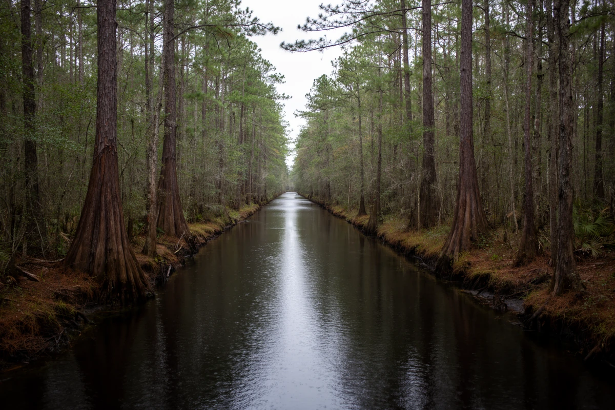
There is no honest way to tell that story except plainly: the canals and drained fields that still define the south county's farm belt were dug and cleared by force.
1862–1864 War on the Roanoke
Plymouth's port economy made it a wartime prize. Union forces occupied the town early in the war and fortified it as a base on the sound. Then, in April 1864, it became the stage for one of the war's most dramatic North Carolina episodes. The Confederacy had spent nearly a year building an answer to Union naval control of the sounds: the ironclad ram CSS Albemarle, constructed not in a shipyard but in a fallow cornfield at Edwards Ferry on the Roanoke in Halifax County, on Peter Evans Smith's farm, under the supervision of a 19-year-old contractor, Gilbert Elliott, with Lieutenant James W. Cooke, CSN, overseeing the work. Neighbors donated tools, a sawmill, and a blacksmith shop to the effort.8
Sources differ on the exact scale of the April 17–20, 1864 battle for Plymouth — figures for the attacking Confederate force under General Robert F. Hoke range from roughly 4,500 to 10,000 men, and the Union garrison under General Henry W. Wessells is put at somewhere between about 2,500 and 2,834; this page doesn't pick one silently. What both accounts agree on is the outcome. On April 19, the newly launched Albemarle steamed downriver, still being ironclad while underway, and sank the USS Southfield, damaged the USS Miami, and drove off the supporting Union gunboats; the following morning the garrison surrendered, in what is generally described as the third-largest Civil War battle fought in North Carolina and the Confederacy's last major victory in the state.9
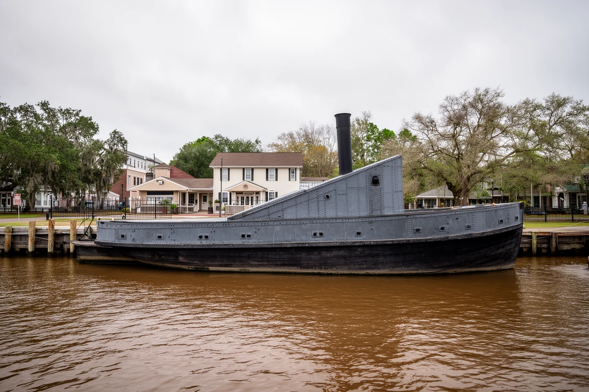
The Albemarle's reign lasted six months. On the night of October 27–28, 1864, Lieutenant William B. Cushing brought a small steam launch up the river in the dark with 28 men, rode it over the log boom protecting the ironclad at her Plymouth mooring under Confederate rifle fire, and detonated a spar torpedo against her hull. The Albemarle sank at her mooring, and Union forces retook Plymouth days later — Cushing's raid is remembered as one of the most audacious small-boat actions of the naval war, and it cost him only two men.10 You can walk this history downtown today: the Port O' Plymouth Museum, in the town's circa-1923 Atlantic Coast Line railroad depot, tells the story, and a 63-foot replica of the Albemarle sits on the river behind it.
April 1864 The Plymouth Massacre
The battle's aftermath is not a footnote to the story above — it is its own chapter, and for most of the last 160 years it went largely untold. Present in Plymouth at the surrender were Black Union soldiers, formerly enslaved people freed under the Emancipation Proclamation, and white Unionist civilians. Confederate policy at the time did not treat Black soldiers as prisoners of war, and eight days earlier, at Fort Pillow, Tennessee, Confederate troops had already massacred Black soldiers who tried to surrender. At Plymouth on April 20, contemporary accounts — including a Union private's diary entry that flatly calls it "a massacre," and the sworn postwar testimony of Sergeant Samuel Johnson of the 2nd U.S. Colored Cavalry — describe Confederate soldiers shooting Black soldiers and civilians after the surrender, some reportedly lined up near the docks. Death-toll estimates vary widely by source, from around 100 to as many as 600, in part because the chaos of refugees fleeing the town left incomplete muster records.11
The state did not formally mark this history with its own historical marker until December 13, 2024, when the North Carolina Department of Natural and Cultural Resources dedicated marker B-79, "Plymouth Massacre," at the intersection of U.S. 64 and Rankin Lane in Plymouth.12 That the marker is barely two years old, in a town whose Civil War history has been publicly commemorated since a 1928 monument, says something about which parts of this history got told first.
That the marker is barely two years old, in a town whose Civil War history has been publicly commemorated since a 1928 monument, says something about which parts of this history got told first.
1890s The Lumber Frontier
After the war, the county's economy rebuilt around what it had always had in abundance: timber. The swamps and bottomlands of the lower Roanoke held vast stands of cypress and pine, and industrial lumbering arrived to cut them at scale. The clearest marker of that era is Roper itself: the old Lee's Mill settlement — the county's original seat of government — took its modern name in 1890, when the John L. Roper Lumber Company, a Norfolk-based operation that at its height controlled roughly 600,000 acres of eastern North Carolina timberland and access to 200,000 more, established works there.13 Rail lines followed the timber, tying Plymouth and Roper into the Atlantic Coast Line network, and the company's mills brought some of the first public water and electric service to several eastern North Carolina towns.
1937–Present 1937: The Mill
The single most important date in modern Washington County history is 1937, when the North Carolina Pulp Company — built by brothers John W. and Herbert Kieckhefer of the Kieckhefer Container Company — opened a pulp mill on the Roanoke just outside Plymouth.14 The mill reorganized the town around itself — payrolls, housing, schools, retail — on a scale the old port and lumber economies never approached. Weyerhaeuser bought the operation in 1957 and ran it for half a century; Domtar acquired it in 2007 and converted the site to softwood fluff pulp, the absorbent material in diapers and hygiene products sold worldwide. The corporate layer has kept moving since: Paper Excellence acquired Domtar in November 2021, and the combined group has continued operating under the Domtar name. The mill still runs today and remains the county's economic anchor.
20th c. Decline & Reinvention
The second half of the twentieth century was not kind to small rural counties in eastern North Carolina, and Washington County was no exception. Mechanized agriculture needed fewer hands, the mill's workforce grew leaner and more automated over the decades, and the population drained steadily away. The 2020 census counted 11,003 people countywide — 3,320 in Plymouth, 485 in Roper, and 207 in Creswell. The North Carolina Department of Commerce's own economic-distress rankings have repeatedly placed Washington County in Tier 1, the state's most-distressed tier — a designation that is re-set every year and should be verified against the current cycle rather than assumed static. Downtown Plymouth holds real bright spots and real vacancies, side by side.
But the county has spent the last decade building a genuine new identity out of the one resource that never left: the land and water. Founded in 2015 by Tom Harrison of the county's own tourism authority, the North Carolina Black Bear Festival — now branded the National Black Bear Festival — is held each June on Plymouth's Roanoke River waterfront, built around the Albemarle-Pamlico peninsula's real black bear population.15 On July 10, 2024, the state fully designated the Roanoke River State Trail's final stretch, making it the first North Carolina State Trail designated for its entire 215-mile length, from Roanoke Rapids to the Albemarle Sound.16
Present The County Today
Pettigrew State Park, on 16,600-acre Lake Phelps south of Creswell, remains the south county's quiet centerpiece — North Carolina's sixth state park, established in 1939 with permanent state ownership following in 1947. The lake itself is far older than any of the history above: archaeologists from East Carolina University and the state's own Division of Archives and History have recovered roughly 30 ancient dugout canoes from its bottom, the oldest radiocarbon-dated to around 2430 BC, among the largest such collections still associated with their original sites anywhere in the southeastern United States.17
Every era above left something physical behind that shows up in a purchase here today. The port era left the 1787 street grid and the historic district's late-Victorian and Colonial Revival housing stock, most of it raised between roughly 1880 and 1930 around an even older core — the district's earliest known building, the Picot-Armistead-Pettiford House, dates to about 1814. The war and its aftermath left the museum, the replica ironclad, and — belatedly — a marker naming what happened after the surrender. The lumber and mill eras left Roper, the rail corridor, and the mill itself, with everything that means for jobs, taxes, and the occasional smell on a south wind. Somerset and the Collins family's canal left the drained, canal-crossed farm belt that defines the south county land market. And the long decline left the prices — the reason a genuine historic river town on a navigable Atlantic waterway is still reachable on an ordinary budget.
Primary Sources & Further Reading
Run by the Washington County Historical Society in the town's 1923 Atlantic Coast Line depot. Covers the port-town and Civil War history, including the Battle of Plymouth and the CSS Albemarle.
Somerset Place State Historic Site
NC Historic Sites' own published history of the plantation, the canal, and the enslaved community Dorothy Spruill Redford's research recovered.
The State Library of North Carolina's encyclopedia project. Source for the county's formation date, naming, and geography.
NC Dept. of Natural & Cultural Resources
NC Highway Historical Marker Program documentation, including marker B-79, "Plymouth Massacre," dedicated 2024.
Sources consulted for this page include NCpedia (the State Library of North Carolina's peer-reviewed encyclopedia project), the NC Department of Natural and Cultural Resources' Highway Historical Marker Program and its own historical blog, the National Register of Historic Places nomination for the Plymouth Historic District (prepared by Davyd Foard Hood, 1990), East Carolina University's published archaeology of the Lake Phelps dugout canoes, Dorothy Spruill Redford's own account of her research in Somerset Homecoming: Recovering a Lost Heritage (UNC Press), and Domtar's own corporate history of the Plymouth mill. Wikipedia was used only to cross-check dates already established by the sources above, never as a sole source for a factual claim. Where sources genuinely disagree — as with the exact troop strength at the Battle of Plymouth, or the Plymouth Massacre's death toll — this page says so rather than picking one silently. Numbered citations for specific claims appear below; nothing here is estimated or invented.
- Plymouth's 1787 founding by Arthur Rhodes, subdividing 100 acres of his Brick House plantation into 172 lots, per NCpedia's geography entry for the town and cross-checked against the Wikipedia-maintained summary. NCpedia, "Washington County," ncpedia.org/geography/washington. ↩
- Plymouth's 1790 designation as a port of delivery, 1808 port of entry, and 1807 incorporation, per the town's own published local history (Port O' Plymouth Museum / Washington County Historical Society) and cross-checked against NCpedia's Washington County entry (as above). ↩
- Washington County's 1799 formation from Tyrrell County and its naming for George Washington, per NCpedia, "Washington County," ncpedia.org/geography/washington. ↩
- The county's 1801 courthouse at Lee's Mill, its 1823 move to Plymouth, and the courthouse's three fires (including the 1862 Union bombardment) are documented on the NC Highway Historical Marker Program's Washington County Courthouse marker and the Wikipedia-maintained summary of the same marker text. ↩
- The November 1784 Collins partnership, 1785 canal construction start, and the June 1786 arrival of roughly 80 enslaved Africans put to work on the canal, per NC Dept. of Natural and Cultural Resources, "Josiah Collins Acquires Somerset Place Assemblage, 1784," ncdcr.gov/blog. ↩
- The 1790 census figure of 113 enslaved people held by Collins, and the nearly 850 enslaved people who lived and labored at Somerset Place across its full 1785–1865 history, per the same NC DNCR source (as above) and Somerset Place State Historic Site's own published history, historicsites.nc.gov/all-sites/somerset-place. ↩
- Dorothy Spruill Redford's decade-long genealogical research and the 1986 Somerset Homecoming reunion of more than 2,000 descendants, per Redford's own primary account, Dorothy Spruill Redford with Michael D'Orso, Somerset Homecoming: Recovering a Lost Heritage (Doubleday, 1988; UNC Press paperback), and cross-checked against the Wikipedia-maintained biographical summary. ↩
- The CSS Albemarle's construction at the Edwards Ferry shipyard in Halifax County, under Gilbert Elliott and Peter Evans Smith with Lt. James W. Cooke supervising, per NCpedia's biographical entry. NCpedia, "Elliott, Gilbert," ncpedia.org/biography/elliott-gilbert. ↩
- The April 17–20, 1864 Battle of Plymouth, per NCpedia, "Plymouth, Battle of," ncpedia.org/plymouth-battle, and the NC DNCR Highway Historical Marker Program's B-79 documentation. Confederate and Union troop figures are reported differently by these two sources (roughly 4,500 vs. 7,000–10,000 Confederate; roughly 2,500 vs. 2,834–3,000 Union); this page states the range rather than resolving the discrepancy silently. ↩
- Lt. William B. Cushing's October 27–28, 1864 spar-torpedo attack that sank the CSS Albemarle, per NC DNCR, "The Ironclad Albemarle and the Battle of Plymouth," dncr.nc.gov/blog. ↩
- The Plymouth Massacre of April 20, 1864 — the killing of Black soldiers and civilians following the garrison's surrender, including Pvt. Charles C. Mosher's diary account and Sgt. Samuel Johnson's (2nd U.S. Colored Cavalry) postwar testimony — per NC DNCR, "Plymouth Massacre (B-79)," dncr.nc.gov/blog, and the American Battlefield Trust's published account. Death-toll estimates in these sources range from roughly 100 to as many as 600; this page states that range rather than picking a figure. ↩
- The December 13, 2024 dedication of NC Highway Historical Marker B-79, "Plymouth Massacre," at U.S. 64 and Rankin Lane, per NC DNCR's press release, "Plymouth Civil War Massacre to be Featured on N.C. Highway Historical Marker," dncr.nc.gov/news/press-releases. ↩
- Lee's Mill's 1890 renaming to Roper and the John L. Roper Lumber Company's scale (roughly 600,000 acres owned, 200,000 more accessible), per local newspaper coverage of a Museum of the Albemarle history talk drawing on Bill Barber's self-published local history, Timber, Land & Railroads: A History of the John L. Roper Lumber Company, reported in the Elizabeth City Daily Advance, "Va. lumber tycoon helped transform NENC following Civil War." ↩
- The 1937 opening of the North Carolina Pulp Company mill by John W. and Herbert Kieckhefer, and the mill's later ownership by Weyerhaeuser (1957), Domtar (2007), and Paper Excellence (2021), per Domtar's own published corporate history, "History," domtar.com/about-domtar/history. ↩
- The 2015 founding of the North Carolina Black Bear Festival by Tom Harrison of the Washington County Travel and Tourism Authority, per the festival's own published history, nationalbearfest.com/about-the-festival. ↩
- The Roanoke River State Trail's full 215-mile designation on July 10, 2024, the first North Carolina State Trail designated for its entire length, per NC DNCR's press release, "Roanoke River State Trail Reaches Full Designation," dncr.nc.gov/news/press-releases. ↩
- Pettigrew State Park's 1939 founding (NC's sixth state park) and 1947 permanent state ownership, and the roughly 30 dugout canoes recovered from Lake Phelps (oldest radiocarbon-dated to about 2430 BC), per NCpedia, "Pettigrew State Park," and East Carolina University archaeologist David S. Phelps's published survey, hosted by UNC's Research Laboratories of Archaeology, ancientnc.web.unc.edu. ↩